
New Zealand’s South Island is a hiker’s dream. From accessible tracks that lead to grand waterfalls and sandy beaches to multi-day backcountry adventures with stunning mountain vistas, there’s something for everyone. To help you plan your adventure, we’ve wrapped up ten of the most loved day hikes in New Zealand’s South Island.
1. Hooker Valley Track, Aoraki / Mount Cook National Park
- Duration: 3 - 4 hours return
- Length: 10 km return (via the same track)
- Elevation Gain: 126 m
- Need to know: Suitable for all ages and fitness levels, including first-time hikers. No dogs are allowed on the track. In winter the track will be snowy and icy.
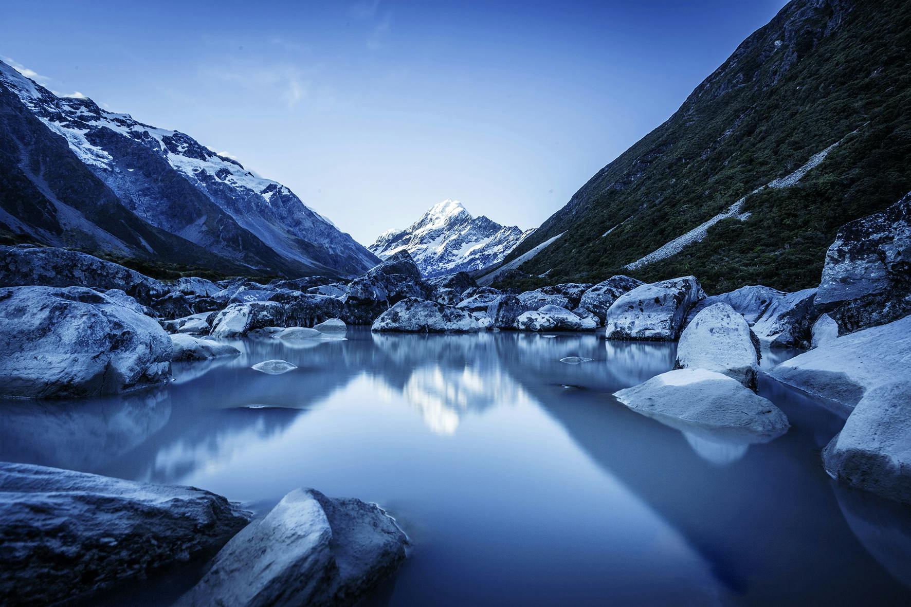
Picture this: snow-capped peaks, glacier-fed rivers, and cheeky Kea birds guiding the way. Interested? Then, strap on your boots and unleash your inner explorer as you embark on the Hooker Valley Track, a dazzling walk through New Zealand's Southern Alps.
Prepare to sway your way across three suspension bridges along the way, all the while absorbing the stunning vistas of Mueller Glacier and Aoraki / Mount Cook.
As you traverse the Hooker Valley, the landscape plays a game of hide-and-seek with elevation and takes you up and down along boardwalks, bridges, and gravel tracks. Wind down with a stroll along the lake, marveling at the panoramic tapestry of nature, and don’t forget to snap your victory selfie with Aoraki / Mount Cook in the background.
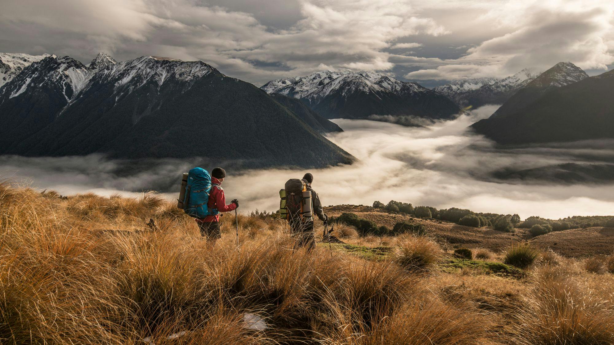
2. Roys Peak Track, Wānaka
- Duration: 5 - 6 hours return
- Length: 16 km return (via the same track)
- Elevation Gain: 1500 m
- Need to know: The track crosses farmland and is closed for lambing season from October 1st until November 10th.
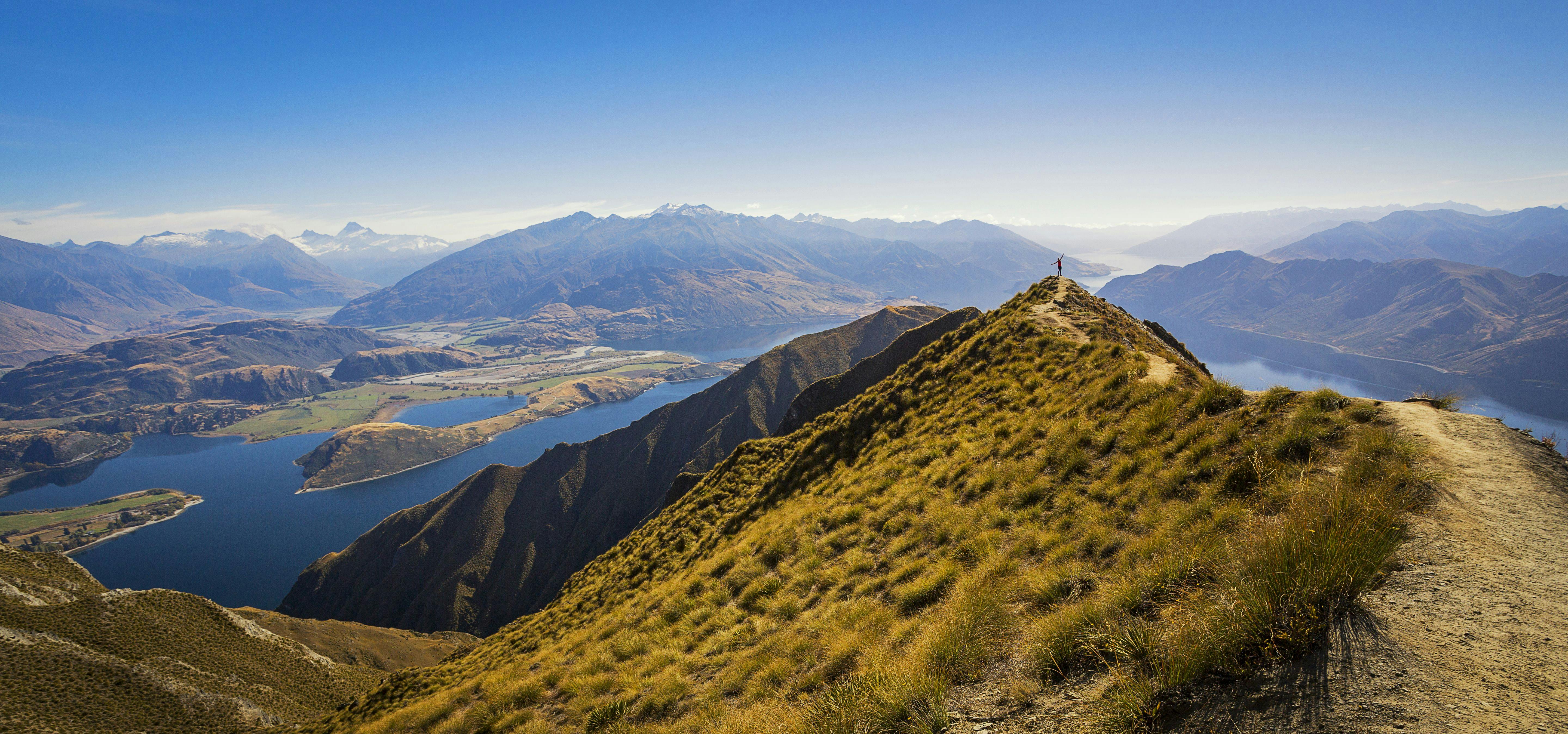
Roys Peak is an immensely popular track, so be prepared for a busy trail and a steep climb to the summit, all with a breathtaking view at the top.
The trail begins at the shores of Lake Wānaka, teasing you with glimpses of the majestic peak. The ascent, a cardio workout, involves a zigzagging 1,578-metre climb across farmlands. Once you reach ‘selfie-point’ the actual summit is another ten minutes uphill from the popular rest spot.
3. Ben Lomond Track, Queenstown

- Duration: 3 - 4 hours return to Ben Lomond Saddle or 6 - 8 hours return to Ben Lomond Summit (advanced)
- Length: 11 km return (via the same track)
- Elevation Gain: 1438 m
- Need to know: In winter you will need to carry and be able to use alpine equipment such as an ice axe and crampons. The track is often slippery and muddy.
The trek to the summit is a full day's walk with over 1,400 m elevation gain, making it one of the most challenging day hikes in Queenstown. On a clear day, you will be rewarded with spectacular panoramic views, and it'll all be worth it. To shorten the hike, you can take the gondola up from the city centre instead of walking up/down and start the track from the top of the gondola.
4. Sealy Tarns Track, Mount Cook
- Duration: 3-4 hours return
- Length: 5.8 km return (via the same track)
- Elevation Gain: 600m
- Need to know: No dogs are allowed on this track. The track climbs 2,200 steep steps straight up.
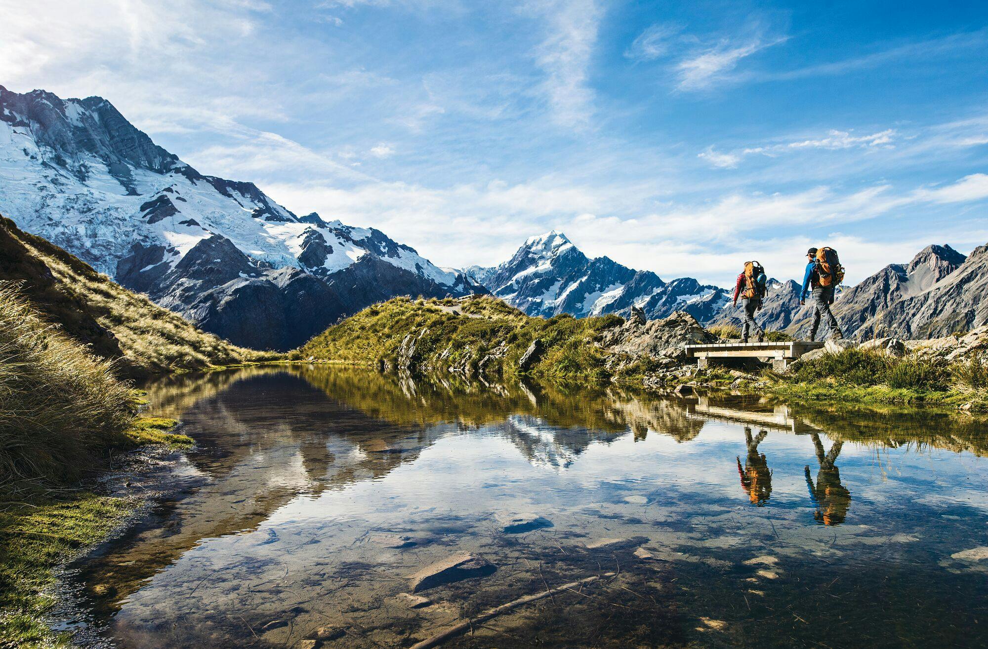
Climb the ‘stairway to heaven’ and get up close to New Zealand's most iconic mountains! After a steady uphill battle, you will be rewarded with spectacular views across the Hooker Valley and the alpine ranges.
The adventure kicks off at White Horse Hill Car Park, leading you up over 2,000 steps carved into the mountainside.
It's a thigh-burning ascent, that will be rewarded with breathtaking panoramic views. Encounter mischievous Kea birds and marvel at the unfolding alpine wonders. At the summit, Sealy Tarns awaits, a sparkling reward for your efforts with great views, alpine flowers, and a picnic lunch spot of your dreams. If you want to carry on from Sealy Tarns, a few more hours of steady uphill will take you to the saddle and Mueller Hut, where you can spend a night (book in advance) or just have a break before turning around.
5. Lake Marian Track, Fiordland
- Duration: 3 hours return
- Length: 6 km return (via the same track)
- Elevation Gain: 400 m
- Need to know: Do not walk around the lake edge during the snow/avalanche season (winter and spring). No dogs are allowed on the track.
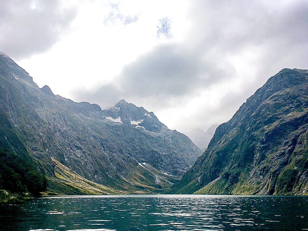
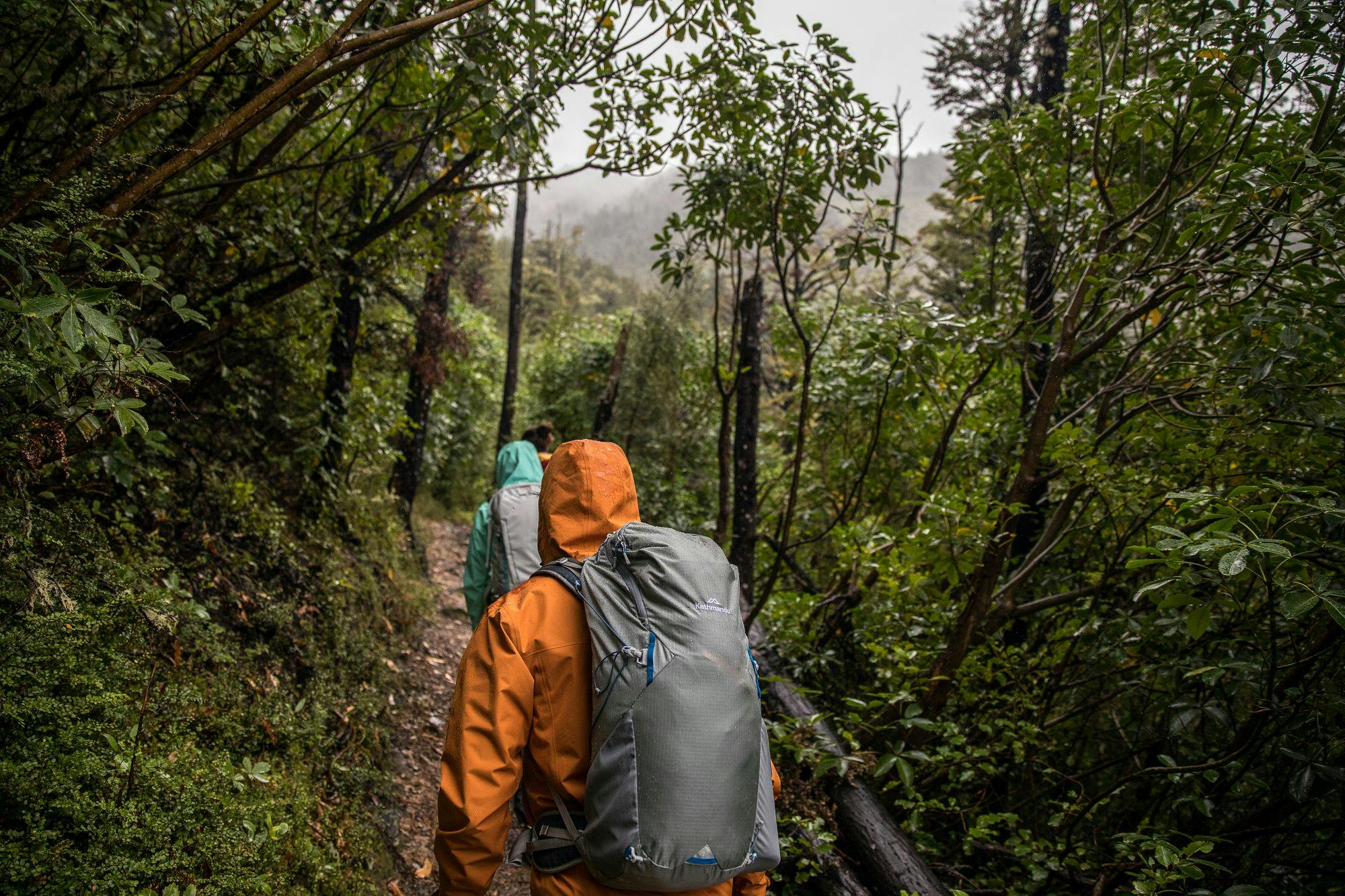
Embark on a whimsical journey through New Zealand's enchanting Fiordland on the Lake Marian Track. The trail, a well-kept secret tucked away in the mountains, starts with a stroll along the Hollyford River. As you weave through ancient beech forests, the elevation gain of 400 metres feels like a gentle game of hide-and-seek with the lake.
Approaching the lake, you'll encounter cheeky fantails and curious robins, adding a touch of feathered magic to the adventure. The trail ends at Lake Marian's crystal-clear waters, surrounded by towering peaks. It's a captivating finale to a journey that feels like a secret whispered by nature herself.
6. Fox Glacier South Side Walkway, Westland
- Duration: 2 hours return
- Length: 6.4 km return (via same track)
- Elevation Gain: 100 m
- Need to know: Glacier viewpoints are hundreds of meters from the face of the glacier. Weather can change quickly in the alpine region and the track may be closed due to flooding or rock falls.
The Fox Glacier South Side Walkway offers a mesmerizing journey through lush rainforest and glacial landscapes. This short trail takes you along the dramatic moraine formations and offers stunning views of the Fox Glacier.
Traverse through native bush, crossing swing bridges over clear mountain streams. Witness the glacier's terminal face and experience the dynamic environment shaped by ice and time. This walk provides a condensed yet captivating glimpse into the unique natural beauty of the Fox Glacier region.
- Duration: 6-8 hours return
- Length: 5 km return (via the same track)
- Elevation Gain: 1100 m
- Need to know: Extremely steep and rocky track only experienced hikers should attempt. The route to the peak is prone to avalanches in winter and spring.
This is a climb for mountain enthusiasts only. The first section of the trail weaves through beech forests, a prelude to the elevation awaiting your ascent. As you gain altitude, the trees part, revealing a rocky ascent as you climb up steeply to approximately 1,833 meters. Upon reaching the summit, the panoramic view of the Southern Alps unfolds.

- Duration: 1.5 hours
- Length: 4.4 km loop
- Elevation Gain: 40 m
- Need to know: No dogs are allowed on this track. The best reflections of the alps can be seen early in the morning or at dusk.
An easy stroll around the beautiful West Coast lake. Best views and reflections of the Southern Alps at dawn and dusk on days with little winds. The path is easy to follow, and the first section is wheelchair-accessible, too. Note that the track and car park can get quite busy, especially in the morning and late afternoon, so plan accordingly.
- Duration: 3.5-4.5 h one way
- Length: 18.4 km return (via the same track)
- Elevation Gain: 420 m
- Need to know: Dogs are not allowed on the trail. Access to the trailhead can be difficult in the winter months. Mt Arthur Hut is located 4.2 km into the hike and can be used for overnight stays on a first come, first served basis.
Located in the Kahurangi National Park the track offers spectacular views with steep climbs across rocky terrain.
This moderately challenging route offers breathtaking panoramic views as you ascend towards the summit. The trail winds through diverse landscapes, from lush beech forests to alpine meadows. Hikers can expect a mix of well-maintained paths and rocky sections. The summit rewards with stunning vistas of the surrounding mountains and Tasman Bay. While the trail is challenging, the awe-inspiring scenery makes it a rewarding adventure for nature enthusiasts and hikers seeking a memorable experience in the heart of New Zealand's South Island.
- Duration: 3 hours (one way) - shorter tracks are also available
- Length: 23 km return (via the same track)
- Elevation Gain: 180 m
- Need to know: Suitable for families, but no dogs are allowed on the track as sections of the walkway cross private farmland.
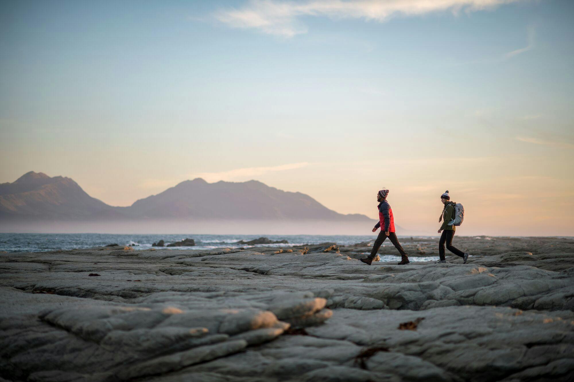
Embark on a coastal excursion along the Kaikōura Peninsula Walkway, where every step is a seaside serenade. Begin your journey in the charming town of Kaikōura, where the ocean breeze welcomes you to the land of seals and sea views. The trail is designed to offer panoramic views of the Pacific Ocean and the surrounding coastal landscapes without significant steep inclines, making it accessible and enjoyable for a wide range of hikers.
Shop Kathmandu Hiking Packs
Keep in mind that all trail conditions and amenities may change, so it's always a good idea to check for the latest information on the DOC website or DOC office close to the trailhead before embarking on your journey. Remember to wear appropriate hiking gear, carry enough water and snacks, and be prepared for changing weather conditions before embarking on a hike.
If you want to stay in any huts overnight check the DOC online booking site for availability and book in advance to avoid being turned around at the end of a long day's hike.